
Research & Development
Enhance your information services with our industry-leading cloudmask technology and advanced Analysis Ready SAR Data, ensuring you meet and exceed customer expectations.


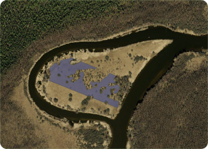
Assessment of Timber Stock and Modeling of Carbon Stock Based on Satellite Remote Sensing to Accelerate the Green Transition and Increase Transparency of the Carbon Market
Satellite-based forest growing stock volume and CO₂ stock estimation in Estonia
Duration 2024–2025
Funder European Regional Development Fund; amount of the grant 98 102 €.
- Models for the quantitative assessment of the growing stock volume and of sequestered carbon in the territory of Estonia


KappaOne S1 ARD layers – weather independent vegetation index
Cloud-independent agricultural monitoring solution
Duration 2024–2025
Funder European Space Agency
- Develop consistent and accurate sNDVI data that is unaffected by cloud cover.
- Provide the sNDVI solution to agricultural experts to navigate changing conditions with greater confidence and agility, regardless of weather patterns.


EO-based open landscape trafficability monitoring for national security and agricultural applications
Timely EO-based open landscape trafficability monitoring solution
Duration 2024–2026
Funder European Space Agency
- Demonstrate the feasibility and potential benefits of using satellite data for estimating landscape trafficability.
- Develop AI models that accurately estimate landscape trafficability with a high spatial resolution.
- Develop a user-friendly daily trafficability service accessible via the Open Geospatial Consortium (OGC) standard interface for end-users, ensuring real-time access to trafficability information.

AI-based tillage detection for improved agricultural and climate policies
Transforming agricultural monitoring with AI and satellite data.
Duration 2023–2024
Funder European Space Agency
- Feasibility study of conservation (i.e. non-inversion) tillage detection with satellite imagery.
- Tillage detection AI models for different tillage types based on Sentinel-1, Sentinel-2, Landsat 8 & 9 imagery time series.
AI-based Cloud Mask Processor for Sentinel-2 : Phase 2
Extending the "KappaMask" processor developed under Phase 1 of the project “AI-based Cloud Mask Processor for Sentinel-2” to global coverage.
Duration 2021-2022
Funder European Space Agency
- KappaMask extended to global conditions, which is compatible with ESA Sentinel-2 L2 processing chain.
- KappaSet, the Sentinel-2 cloud and cloud shadow dataset, distributed geographically throughout all seasons over the globe.
Satellite monitoring services for crop insurance
Enabling novel and more efficient solutions for customer pooling and loss adjustment processes in crop insurance.
Duration 2022 – 2023
Funder European Regional Development Fund and Enterprise Estonia; amount of the grant 434,760 €.
- Satellite monitoring prototypes for customer pooling and loss adjustment processes in crop insurance and user feedback related to it.
Harvesting Time Recommendation for maximum crop Yield (HaTRY)
Predicting the best time to harvest crop using remotely sensed data
Duration 2020–2021
Funder European Space Agency
- Prototype service for Precision Farming application to predict and recommend the most favorable harvesting time for maximum crop yield.
- Focus on Northern Europe region and three most common crops: winter wheat, spring barley and winter rapeseed.
- Learn and collect farmers requirements for a fully operational service.
Grazing detection from Copernicus data for agricultural subsidy checks
A complete satellite-based grassland monitoring service
Duration 2020–2021
Funder European Space Agency
- Develop grazing detection methodology based on Copernicus data (Sentinel-1 and Sentinel-2 imagery time series).
- Provide the NPA operators means to carry out checks on grasslands using EO data and substituting on the spot checks of grassland grazing activity with new EO data based grazing detection methodology.
- Close the grasslands subsidy checks case for CAP satellite monitoring
AI-based Cloud Mask Processor for Sentinel-2
Develop new and better cloud mask than existing ones
Duration 2020–2021
Funder European Space Agency
- Reliable cloud mask processor for Northern Europe region, which is compatible with ESA Sentinel-2 L2 processing chain.
- Create high quality reference dataset for future developments.
- Use innovative deep learning techniques in cloud masking.

National Programme for Addressing Socio-Economic Challenges through R&D (RITA). Using remote sensing data in favour of the public sector services
Monitoring the use of agricultural land
Duration 2019–2020
Funder This study was financially supported by the European Regional Development Fund within National Programme for Addressing Socio-Economic Challenges through R&D (RITA).
- Mature, reliable and tested crop classification methodology development specifically suited for Estonian agricultural, ecological and climatic conditions.
- Multi-year country-wide testing and error analysis about vegetative seasons 2018–2020.
- Crop classification model prototype with test datasets.

Monitoring of Agricultural Grasslands With Time Series of X-Band Repeat-Pass Interferometric SAR
ESA Business Incubation
Improving our software quality during the incubation phase
Duration 2018–2019
Funder European Space Agency
- Satellite imagery model development
- Software architecture definition and review
- Software implementation
- Market analysis and business plan development
- Improved web map for visualizing our analysis results

Detection of mowing events on grasslands from Sentinel-data
The first nation-wide system for automated monitoring of agricultural practices in EU
Duration 2016-2018
Funder Estonian Agricultural Registers and Information Board (ARIB)
- Nation-wide fully automated mowing detection system operational in Estonia from 2018
- Sentinel-1 and Sentinel-2 time-series for operational near real-time monitoring
- 85% of detection accuracy of the mowing events on grasslands
- Automated “early warning” reminders to applicants

Data Analytics for Optimizing Agricultural Monitoring
Going beyond the mowing detection powered by high-level data analytics expertise
Duration 2017-2018
Funder Enterprise Estonia, project No. EU48684
- Develop a scientifically validated methodology for ploughing and grazing events detection from Sentinel-1 and Sentinel-2 time series
- Bring to customers a new cultivation and grazing detection product prototype
- Involve high-level data analytics expertise powered by STACC.

Grassland mowing detection for agricultural subsidy checks with Sentinel-1 and Sentinel-2
Looking over the borders to Denmark, Sweden and Poland
Duration 2017-2019
Funder European Space Agency, Industry Incentive Scheme (ESA IIS)
- Validate the service by performing user trials in Sweden and Denmark
- Enhance the existing cutting and grazing detection methodology
- Study Earth Observation Community Platform (EO CP) service providers
- Perform Viability Analysis
Home page and demo application
KZ branding, home page and demo application
Duration 2017
Funder Enterprise Estonia, project No. EU51738; amount of the grant 14,960 €.
